Thursday, September 14, 2006

Photo of a red sprite!


I personally tried to catch sprites using my digital camera (Canon EOS 5D) last Monday night at Mont Aigoual. Using a 50 mm lens at f/1.8, ISO 1600 and exposures of 4 seconds, I got my first sprite colour photo! I knew immediately that something happened, because I saw the sprite with my own eyes, while the UFOCapture software made a detection sound. It still was a question whether the camera would be sensitive enough to record the very brief flashes.
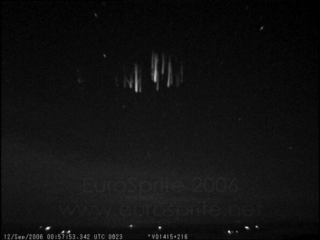
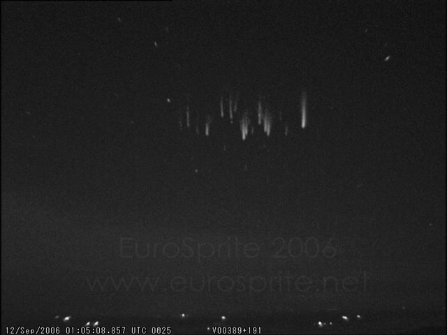
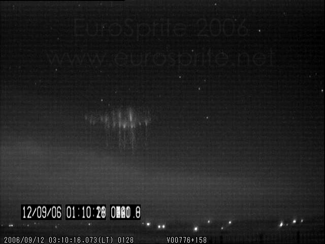
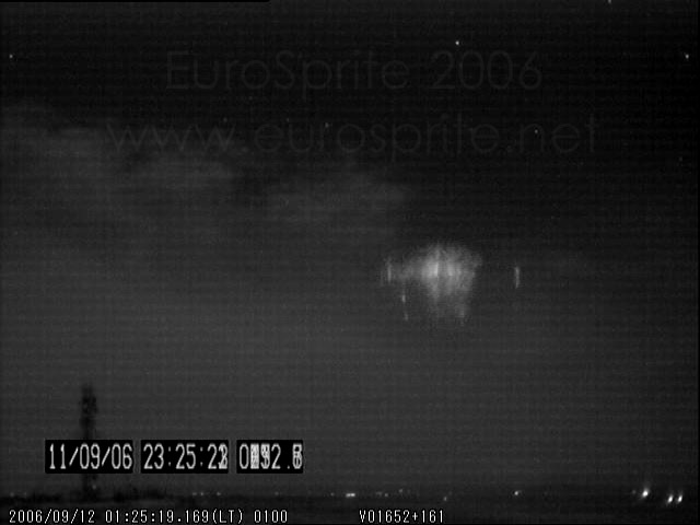
The video images show a series of columns followed by a group of large carrots:

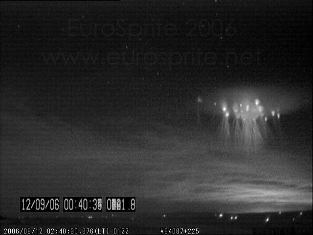
I actually saw these as narrow white columns with my eyes. I was able to record a few more sprites (by taking many shots), but did not see any with my eyes. One jellyfish sprite was just missed by my camera and my eyes although I did see the bright cloud flash.

The larger photo can be seen at my website www.lightningwizard.com
(Storms gallery or Latest)

September 11th: 28 sprites from Mont Aigoual

Last Monday evening the Toulouse team, now assisted by Michal Ganot from Tel Aviv and her extra sprite camera (Watec 100N with 12mm f/0.8 lens) and GPS time inserter, arrived at the observatory on Mont Aigoual. We were a bit late as it was already dark when we arrived. Carl-Fredrik sms-ed us that Pic du Midi was cloudy. Our first camera (Watec 902H with 16mm f/1.4 lens) was set up and very soon captured a sprite amongst some clouds at 20:18 UTC. One hour later the camera recorded already 9 events, mainly groups of columns. The other camera was now running as well and used the time inserter. We had arranged the two to have some overlap on the sprites, for timing accuracy, and to cover a bit wider view.


column sprites dancing on visible lightning flashes:


The mesoscale convective system southeast of Bordeaux produced sprites in three periods since we observed: 20:18-21:49 UTC with 13 events (peaks near 20:50 and 21:20), 23:17-23:37 with 5 events, and 00:09-01:10 with 10 events. For 20 events we have accurate time stamps.

18 events were (more or less) purely column sprites, mostly in groups:


(this last one has long tendrils, these are not classic columns)

5 events contained carrot sprites, sometimes together with groups of columns:


2 events featured a big jellyfish (large tendrils, short bodies embedded in sprite halo):


and 3 events could not be classified easily (sometimes because of clouds):


In several cases the events contained multiple sprites separated by a few hundred milliseconds.

We left Mont Aigoual Wednesday afternoon, after a very foggy and later cloudy night with no chance of improvement.

The images are stacked output from UFOCapture, interlacing removed, black point contrast enhancement. Those of the Watec 100N with time inserter were captured with 640x480 resolution which apparently resulted in the grid pattern, only in the stacked images. Not all sprites are shown.

Wednesday, September 13, 2006

Cloudy sprites from Pic du Midi


The night of September 12-13 has thus far been cloudy. However one event was captured in the narrow-FOV camera at 22:09 UT.

Sunday, September 10, 2006

A stormy week ahead!

Some news!
You didn't see the catch made by our head of the project, Torsten Neubert, but he caught 11 sprites in the night of 17-18 August.
Now we finally get into the good weather pattern again. These days there have already been thunderstorms over France and Spain, but a bit unorganized. This should change starting Monday.

Monday-Tuesday: thunderstorms along the southwest coast mostly, should be more organized/long lived than last few days. Mont Aigoual should stay clear. Let's hope so too for Pic du Midi.

Tuesday also southwest France but maybe better, the east coast of Spain! Mont Aigoual and eastern Pyrenees will have low cloud base heights, however, so we must hope we get clear skies most of the time...

Wednesday something really big is forecast by GFS model, ahead of the serious upper trough, with most of France and northern Spain getting very dynamic storms in the evening. However for the Thu 00-06 UTC timespan, Mont Aigoual gets the absolute Hotspot of Precipitation of France, with more than 40mm! Continuing even into 12 UTC. ECMWF and UKMO models seem a bit slower with the cold front.

Remaining storms at the Mediterranean Sea for the night of Thu-Fri, when the cameras will be behind the cold front. Probably cloudy then but who knows.

Fri-Sat night, storms over the Mediterranean, close to Spain and Corsica, low pressure area near Mallorca (GFS) or Corsica (ECMWF - but strong upper trough over Spain). This will continue for a few days.

It really looks like a week with many potentially good days! Let's hope this also goes for clear skies over all of the camera sites...